Shenandoah Hiking - See the Sights in
Shenandoah National Park
Introduction.
Shenandoah National Park is very popular and widely visited due to its proximity to eastern U.S. locations. The park receives approximately 1,500,000 visitors each year, and encompasses both the iconic Blue Ridge Parkway and Skyline Drive. While there are a number of sources for information on the different regions of the park, including the National Park Service, the intent of this post is to provide a suggested path for you to take, for mapping out your visit, based on our personal experiences. I have used an approach of suggesting a larger number of shorter hikes/stops vs. very long or overnight treks, so you can see a wider variety of sights and different areas within Shenandoah’s boundaries.
General Logistic Information.
There are multiple entry points into Shenandoah National Park and the order of activities listed below is not intended as a sequential list of activities. Rather, you should make adjustments based on your specific entry point to the park. For us personally, we entered at the Swift Run Gap entrance, based on our lodging location being the Massanutten Resort in McGaheysville, Virginia.
As always, there are a few visitor areas and what they call “Waysides” within the park where you can get some basic supplies and food, either in a sit down environment or to go, though once again I found that these are not always convenient and I do not want to have to change my plans to get food/meals. Therefore, I suggest you either plan to bring your own food or arrange your activities to be near one of these locations, so that you don’t have to interrupt your time in nature.
Shenandoah Hiking Activities.
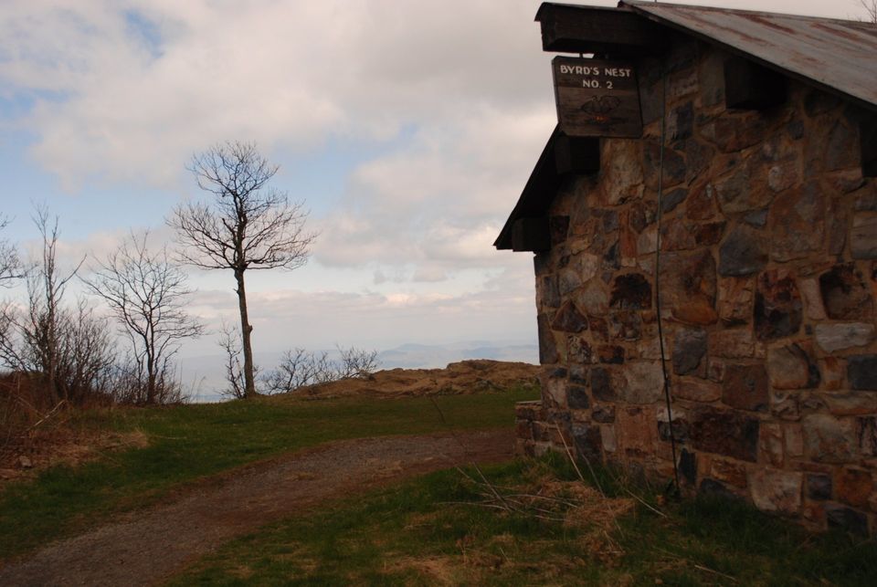
- First stop is the trailhead for Hawksbill Mountain. This is a 2.8 mile loop hike and it doesn’t really matter which way you go, you will hit all the noted sites regardless of your direction. We chose to do the climb portion first and made our way up to the Bird’s Nest 2 building, at the summit. This is a great spot for some long range photos.
- Leaving this point, you connect to another trial called Salamander Trail. This Shenandoah hiking trial begins your decent and provides the bonus of connecting you to the Appalachian Trail. You go a pretty good distance on the Appalachian Trail at this stage, and although you will certainly not be doing the 2,100 mile hike from end to end, you can get some bragging rights of having hiked part of the AT.
- You will continue along passing through lush foliage and passing by some interesting geological formations. You will catch some views of Skyline Drive and finally work your way back to the trailhead at the starting point.
- Next stop is Lewis Falls Trail. This trail will work you down through the woods, along the trickling stream that leads to the falls, and eventually to the Lewis Falls overlook.
- At the Lewis Falls overlook you will have plenty of photo opportunities of the falls and of some wonderful long range mountain shots. Then it’s back up the trail and on to the next location.
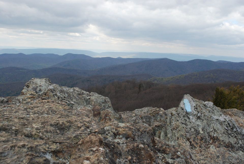
- The next stop is the Bearfence Mountain trailhead. This is a somewhat challenging hike for an approximate distance of 1.2 miles round trip. You ascend the trial and eventually get to scramble over some large boulders to get to the summit. Here you will be able to get some of those postcard shots of the Blue Ridge Mountains (Note: the blue trail marker on the boulders, which is your trail).
- Take in the sights, relax for a while, and then begin your hike back to the trailhead.
- At this point, if you have completed the hikes listed in this section, you have probably reached the end of your day and are ready to call it a day.
_______________________________________________________________________________________________________________________________
_______________________________________________________________________________________________________________________________
- For this day of Shenandoah hiking activities, you will be exploring the northern section of Shenandoah National Park. You have the option of entering the park through the Swift Run Gap entrance and driving north inside the park, or traveling north on local roads and entering the park through the Thornton Gap entrance. Either way, one of your stops should be the Mary’s Rock South trail.
- This is a 2.6 mile roundtrip hike that takes you through wooded areas, past multiple types of wildflowers, past some historic remains, and finally to Mary’s Rock summit.
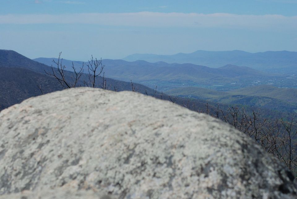
- You will actually have a birds eve view of the Thornton Gap park entrance here, along with some beautiful long range views of the Blue Ridge Mountains.
- The next stop is the Stonyman Summit trailhead. This is a relatively easy 1.4 mile roundtrip hike.
- Along this trial you will intersect with the Appalachian Trial, and this is actually this highest point of the AT within Shenandoah National Park.
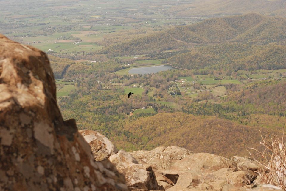
- Further on, the summit gives you an opportunity for some great views, and even the possibility of spotting a peregrine falcon, as this is the location where they have been reintroduced by the National Park system.
- Unfortunately, I was only able to catch a view of some turkey vultures, but the sight of them soaring through the wind currents was very enjoyable.
______________________________________________________________________________________________________________________________
______________________________________________________________________________________________________________________________
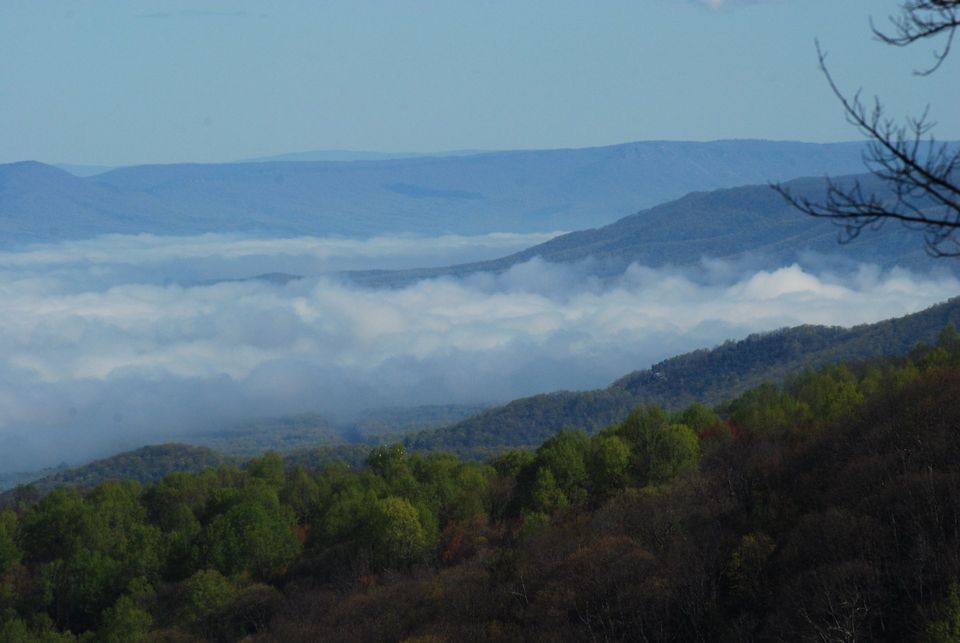
- On our final day, we again entered through the Swift Run Gap entrance and this time headed towards the southern portion of the park. As the Blue Ridge Parkway climbs to some significant elevations, there is always the chance that you can get an interesting and unusual view of the valleys below (known as “an inverse”).
- Our first hike for this day was Blackrock Summit.
- For the adventurers, the great part of this hike is the rock scramble at the end of the trail. It is not for everyone and will require some climbing on “all fours” to get to the top, though the extra elevation does provide some enhanced views.
- Our final Shenandoah hiking adventure was to South River Falls. This hike descends through the woods, gives you some great views of local wildflowers, and at times runs parallel to the creek/stream that eventually becomes the falls.
- In either direction of your hike, there are some very beautiful photo shots of the woods and the water, as it cascades down towards the falls.
- This is a 2.6 mile roundtrip hike, so remember to save some energy for the return hike, which is mostly an uphill grade.
- There is a nice viewpoint at the lower end of the trail where you get some good views of the South River Falls.