Death Valley Hiking - Delve into Death Valley National Park
Introduction.
Death Valley is America's driest and hottest spot. The park's boundaries includes the lowest elevation in the Western Hemisphere, that being 282 feet below sea level. In spite of it's barren environment you will find rocks sculpted by erosion, richly tinted mudstone hills and canyons, giant sand dunes, and sometimes in springtime, abundant wildflowers among more than a thousand varieties of plants. Animal life consists of bobcats, kit foxes, ancient fish, rodents, coyotes, bighorn sheep, and hawks.
Surprising as it may be, there is a great diversity of life that survives in Death Valley.
General Logistic Information.
There are multiple entry points into Death Valley National Park and we chose to enter near Shoshone, California, which is about a 2 hour drive from Las Vegas, Nevada. You must have your own vehicle to visit Death Valley National Park.
There are a few lodging locations to stay within the park and each of them includes a restaurant and has take-out options. Most centrally located you will find the area known as Furnace Creek, where there are 2 options. The Ranch at Furnace Creek which offers casual, family like accommodations and The Inn at Furnace Creek which is a four-diamond resort and spa. A bit further north, there is Stovepipe Wells Village which offers resort accommodations and some recreational vehicle camping options. We decided to stay at The Ranch at Furnace Creek, which was comfortable, satisfied our needs for accommodations and meals, and was significantly less expensive than The Inn at Furnace Creek. As always, I recommend you either plan to bring your own food during the day or arrange to pick up to-go lunch boxes, and you will certainly find many beautiful locations to stop and enjoy your lunch.
Death Valley Hiking Activities.
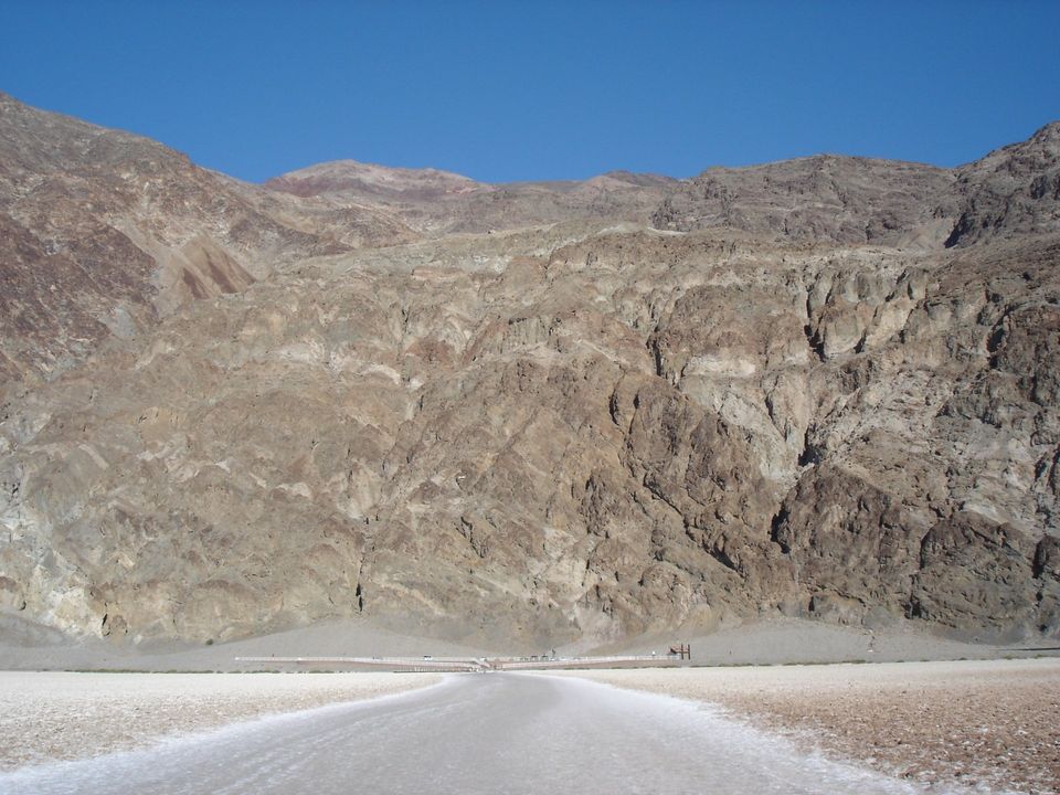
- First suggested stop is Badwater, home of the lowest elevation in the Western Hemisphere.
- Take the short hike on the boardwalk trail.
- Then take a longer hike off the boardwalk onto the salt flats and out to the lowest elevation point.
- This provided a great view back towards the Badwater parking area with the mountain range in the backdrop. As a side note, this mountain in the background is where you will ascend if you make the drive to Dante's View.
- Continue driving north to Devils Golf Course.
- Here a short drive off the main road takes you where you can view the salt pinnacles.
- You will not actually be playing any golf on this course.
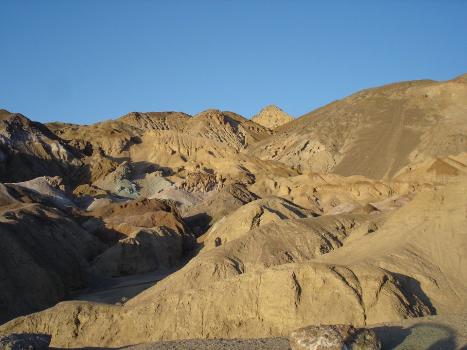
- Proceed a little further north to Artist's Drive.
- This is a 9 mile one-way paved roadway where you pass through spectacular colors formed by layers of volcanic ash.
- There are many pullout spots along the road, and you should have plenty of opportunity to get some great pictures.
- Based on our day of driving from Las Vegas and exploring a good number of locations within Death Valley National Park, we decided to check in to The Ranch at Furnace Creek for the evening.
- A personal recommendation here. Later in the evening, well after dark, take a drive at least a few miles back into the park, to one of the roadside pullouts. Turn off your vehicle, wait a couple of minutes for your eyes to adjust, and then gaze at the sky and abundance of stars. It is a glorious sight.
________________________________________________________________________________________________________________________________
________________________________________________________________________________________________________________________________
- The day started out at the Visitor's Center for the usual browsing around, talking with Park Rangers, and getting some additional information on park activities and Death Valley hiking options.
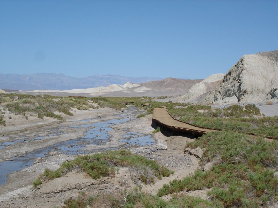
- Leaving the Visitor's Center, drive north to get to Salt Creek.
- There is a hike on a 1 mile boardwalk that takes you to the home of the rare pupfish.
- These fish have existed in some estimates for 20,000 years, and along the way had to adapt themselves from being fresh water fish to salt water fish, after Lake Manly dried up and left them stranded.
- Springtime months are probably the only time you will see these creatures.
- We then took the relatively long drive to Scotty's Castle, a mansion previously owned by Chicago millionaire Albert Johnson.
- There are a number of activities available including a Park Ranger guided tour, exhibit areas, walking trails, and a technology tour where you can learn about some of the innovations employed at the Castle.
- We took the ranger guided tour which was quite educational and provided some good entertainment, based on the presentation by the Park Ranger.
- Since you are in this area of the park, make the drive over to Ubehebe Crater, which is located relatively close to Scotty's Castle.
- The history is that this was created when hot magma came into contact with water, some 3,000 to 5,000 years ago, when the steam explosion blew a hole in the ground some 600 feet deep.
- Take the hike around the rim of the crater where you see cinders from the explosion and also make a short detour to see Little Hebe crater along the hike.
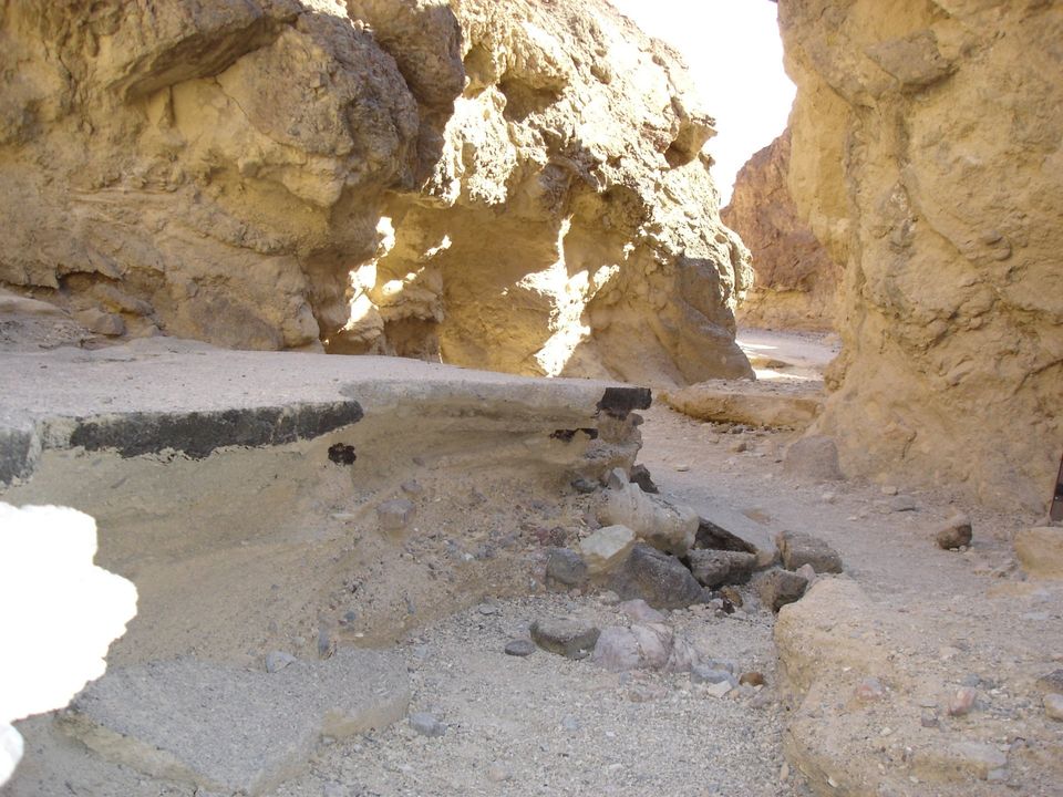
- Heading back towards the Furnace Creek area, our last stop for the day was at Golden Canyon for some more Death Valley hiking.
- Here you should take the 2 mile roundtrip hike into the canyon, which is a relatively easy hike. However, the environment can be quite hot in this area, so be prepared physically and with water.
- The road no longer goes into the canyon, and you will see why when you pass remnants of the road that was washed away by water during a storm. Note to self.... Make sure there are no storms approaching or predicted, before taking this hike.
- Taking this hike in the afternoon, as we did, provides you with great views into Golden Canyon where the walls are covered in red and gold light.
________________________________________________________________________________________________________________________________
________________________________________________________________________________________________________________________________
- On our last day in Death Valley National Park, we headed towards Zabriskie Point, named after Christian Zabriskie who was the general manager of the borax salt operations in Death Valley.
- Drive to the viewpoint for some interesting sights of an ancient lake bed that has been eroded into unusual shapes.
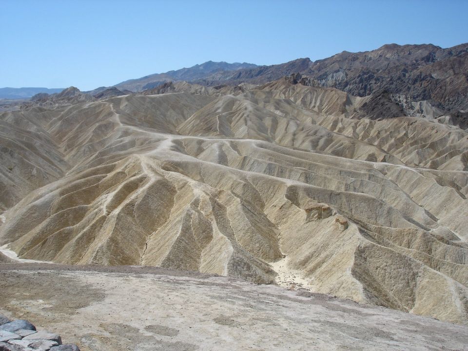
- This is a very popular location for viewing sunrises or sunsets, if your schedule allows.
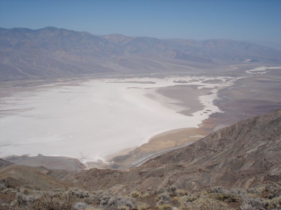
- Make the drive, heading south, to Dante's View. You will pass an intersection for Hwy 190, which can be used as an exit point from Death Valley National Park, depending on your plans.
- The view from Dante's View, at over 5,000 foot elevation, is probably the only place that you can try to comprehend the scope and enormity of Death Valley.
- Below you will be the giant salt pan, the roadway you traveled through the valley, and the west side of the valley where you will be looking towards the Panamint Valley and the Cottonwood Mountains, where Sentinel Peak rises to approximately 10,000 feet.
- Many people shy away from areas like Death Valley, too hot, barren desert, nothing to see, and so on. These impressions are very far from the truth, and I personally believe you will enjoy a visit to Death Valley National Park as long as you are prepared and take a few basic precautions.